Mobilkit: A Python Toolkit for Urban Resilience and Disaster Risk Management Analytics using High Frequency Human Mobility Data
Increasingly available high frequency location datasets derived from smartphones provide unprecedented insight into trajecto- ries of human mobility. These datasets can play a significant and growing role for informing preparedness and response to natural disasters.
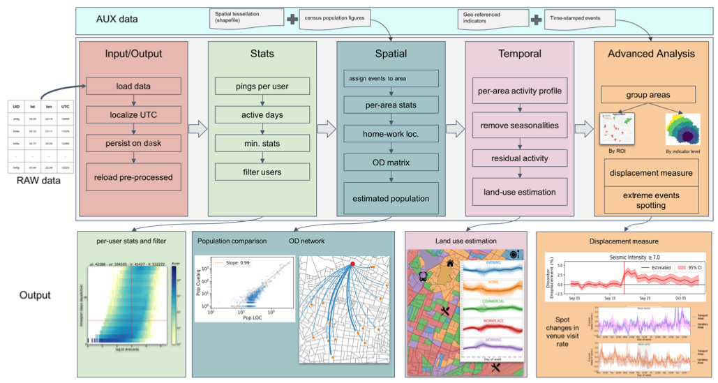
However, limited tools exist to enable rapid analytics using mobility data, and tend not to be tailored specifically for disaster risk management. We present an open-source, Python-based toolkit designed to conduct replicable and scalable post-disaster analytics using GPS location data. Privacy, system capabilities, and potential expansions of Mobilkit are discussed.